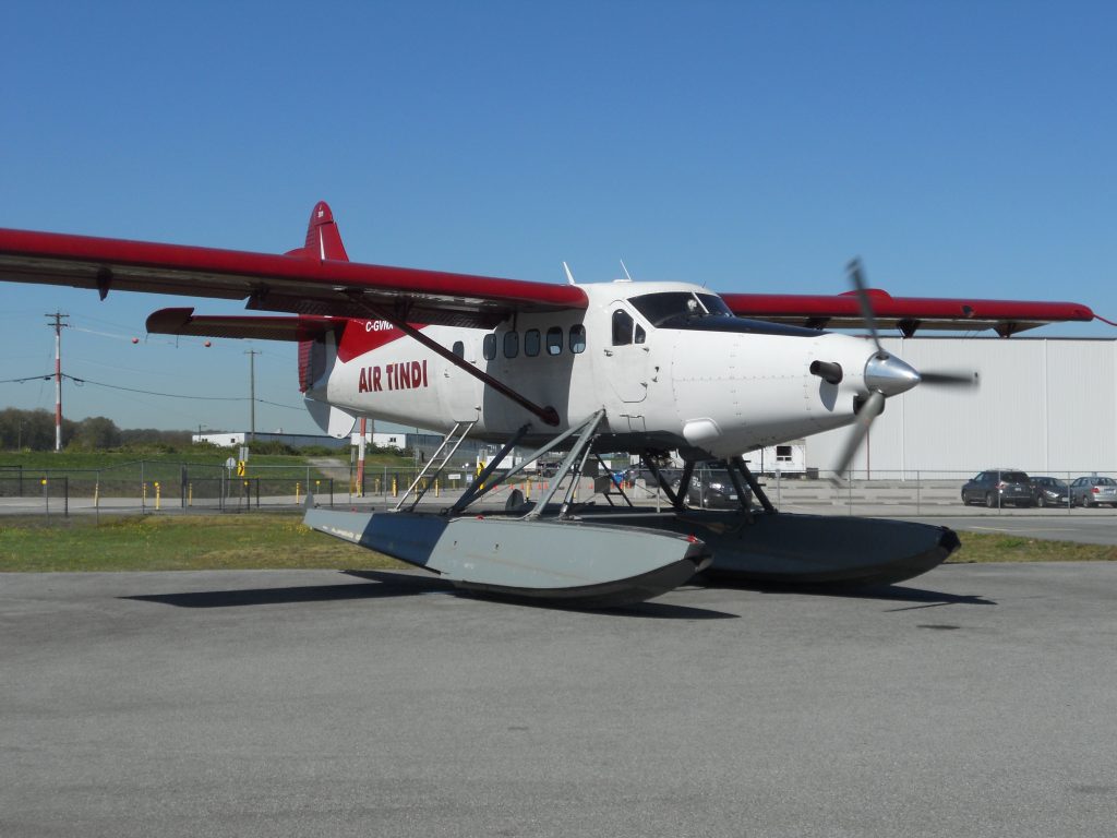
Maxcraft teamed up with Air Tindi to transform this 1959 Turbo Otter into a modern IFR workhorse. Operating in some of the most remote regions of Canada, Air Tindi has some unique operational challenges. This all glass cockpit will bring an added level of safety to their crew and passengers, along with a fresh new look, which is arguably better than when it left the factory.
Classic Canadian Bush Plane Modernization Project
1959 De Havilland DHC-3 Turbo Otter
Aircraft & Owner:
The de Havilland DHC-3 Otter is one of the most iconic bush planes in Canadian history. The Otter was designed to complement the already successful de Havilland Beaver, which itself is a Canadian icon. Despite only being produced for a short period between 1951 and 1967, the Otter is still a top choice for air carriers in Canada and the across the world. The Otter was originally equipped with a massive piston radial engine, this particular Otter has been equipped with a PT6A 750HP turbine engine increasing both reliability and performance. Air Tindi is Northern Canada’s leading air charter and scheduled service provider. Canada’s North is home to some of the most remote places on Earth. With some of these places only being accessible by aircraft, Air Tindi provides a vital link to community members with daily scheduled flights, Air Ambulance services, and charter flights. With a diverse fleet of over 25 aircraft, Air Tindi can fly anywhere in North America from their base in Yellowknife, NWT. Even in places where the nearest airport is hundreds of kilometers away, Air Tindi can get there thanks to their highly skilled crew, and aircraft on skis, floats, and tundra tires.
Need:
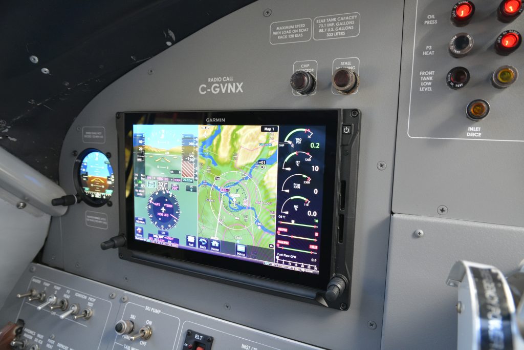
The Otter being a single-pilot aircraft, combined with Air Tindi operating in some of the most challenging flying environments, safety was a major driver for this project. The Garmin G600 TXi is a large 10.6 inch which replaced and consolidated the many analog instruments onto a single easy to read touchscreen display. The attitude, altitude, airspeed, and other vital flight data is displayed in an easy to read, standardized format, alongside a customizable multifunction display which allows the pilot to use half of the display to pull up charts, a moving map, traffic, terrain and a multitude of other information rich menus. The right side 20% of the PFD is reserved for the Engine Information System (EIS).
The TXi engine information system replaces the aging analog engine instruments with a reliable digital system which displays and records all the relevant engine parameters. With all the engine information in one place, the pilot is able to tell with a quick glance that everything is running smoothly, and in the event of an abnormal reading, the pilot will be notified with an annunciation on the primary flight display allowing them to take action quicker. Since all of the engine data is recorded, this data can be sent to Air Tindi’s maintenance department where they can spot abnormal trends to make corrections before problems become noticeable to the pilots, and before they become more costly problems.
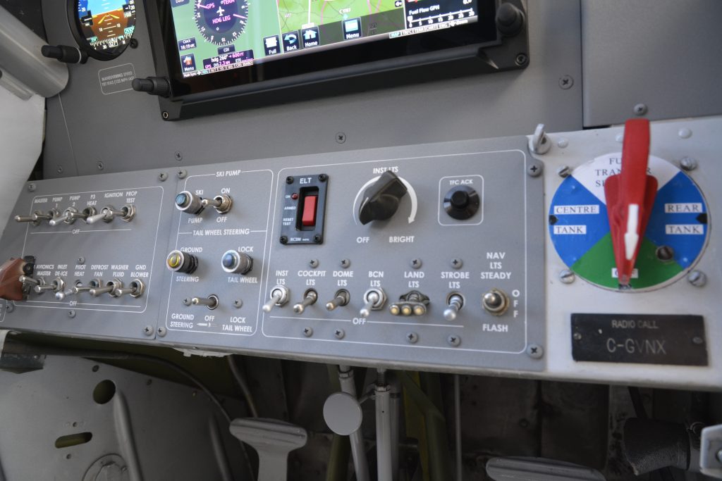
With much of Air Tindi’s operations being into and out of remote areas, the synthetic vision technology and terrain alerting will provide an additional layer of safety to the pilot. Synthetic vision will display a 3D depiction of the terrain around the aircraft and will display the terrain in different colours depending on the risk of collision. The terrain alerting function uses the same terrain database as synthetic vision to provide both visual and audible alerts when a potential terrain conflict is detected. A switch mounted on the instrument panel allows to pilot to toggle the terrain warnings on and off which is an important capability on a float equipped aircraft. Many of the waterways Air Tindi operates in and out of are surrounded by terrain which would trigger alerts. While the pilot can continue flying while the alerts blast in their ear, this creates a dangerous level of complacency leading to the pilot becoming desensitized to terrain alerts.
Complimenting the terrain alerting functions is Garmin’s GRA 55 radar altimeter. This cost-sensitive unit provides the pilot with a highly accurate height above ground level (AGL). By sending a radar signal straight towards the ground and measuring how long it takes to receive the bounced signal, the GRA 55 can determine exactly how high above the ground the aircraft is. The all-digital design of the GRA 55 intelligently processes hundreds of altitude readings every second while filtering out anomalies, and feeding this data to the G600 TXi where the radar altitude is displayed next to the traditional altimeter tape on the primary flight display.
While modern electronic flight displays are incredibly reliable, aviation is all about redundancy. To the left of the G600 TXi PFD is Garmin’s GI 275 electronic flight instrument. This small 3-1/8 digital display is equipped with a backup battery so even if the entire aircraft electrical system fails, the GI 275 will continue providing the pilot with vital flight information for up to 60 minutes allowing them to get the aircraft safely on the ground.
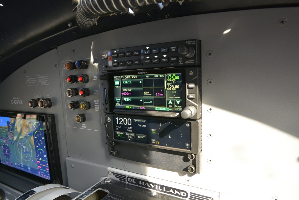
Coming to us equipped with a GNS 430 GPS, which was introduced in 1998, it was time to modernize this aircraft’s communication and navigation capabilities. Garmin’s GTN 650Xi is one of the top of the line options for aircraft GPS today. This compact, 4.9 inch touchscreen unit combines the capabilities of a GPS, VHF navigation receiver, and a VHF Communications transceiver. Additionally, the GTN 650 Xi can be used as a multifunction display, allowing the pilot to pull up a wide variety of information in just a few taps on the screen. Terrain, traffic, satcom controls, and dozens of other features are all centrally controlled from the GTN 650 Xi.
Garmin’s GSR 56 will provide an important safety net, especially when flying in the remote areas of Canada’s North Air Tindi often operates. The GSR 56 is a satellite link which provides worldwide connectivity to the aircraft. This includes 2-way voice and text communications, automatic position reports which allow Air Tindi dispatch crew to follow the aircraft in real time, and a variety of weather products to aid pilots in making strategic decisions while in flight in suboptimal weather conditions.
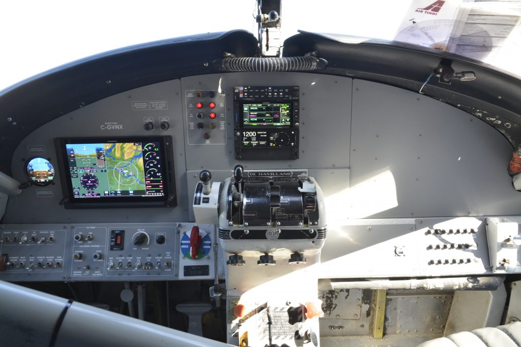
NEW EQUIPMENT LIST
| G600 TXi | Integrated Primary Flight Display with Synthetic Vision Technology (Garmin) |
| G600 TXi EIS | Integrated Turboprop Engine Information System (Garmin) |
| GI 275 | Backup Electronic Flight Instrument (Garmin) |
| GTN 650 Xi | Touchscreen Flight Navigator/GPS/Comm (Garmin) |
| Flight Stream 510 | Wireless Cockpit Connectivity (Garmin) |
| GMA 350C | Digital Audio Panel with Bluetooth (Garmin) |
| GSB 15 | USB Charging Ports [A/C] (Garmin) |
| GRA 55 | Radar Altimeter (Garmin) |
| GSR 56 | Satellite Connectivity (Garmin) |
| MaxPanel | Custom Powder Coated Upper and Lower Panels (Maxcraft) |
The Story:
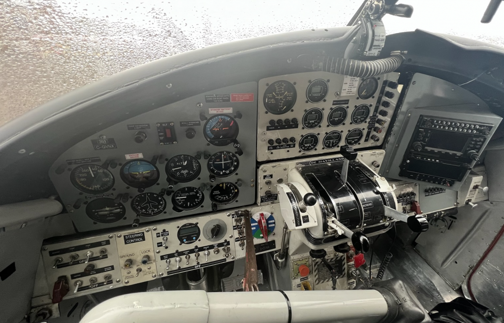
Although this aircraft is a workhorse, both Air Tindi, and ourselves wanted to make this classic Canadian bush plane look like an award winning show plane. The custom designed and cut instrument panels truly make a world of difference. With both the upper and lower panels replaced the colour, text style, and formatting is identical across the entire instrument panel. A lot of time went into making this panel perfect. With lots of back and forth between Air Tindi and Maxcraft, along with consultation with their pilots, we made this panel both beautiful and ergonomic. This aircraft came to us with panels with mismatching colours and flaking paint, and left looking better than the day it left De Havilland’s factory.
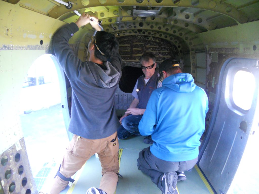
While Air Tindi is based in Yellowknife, NWT, this Turbo Otter was flown to Maxcraft from Campbell River, BC on Vancouver Island where it was undergoing unrelated upgrades. Maxcraft coordinated with Air Tindi to find a production slot that worked for everyone’s timeline. After our work was completed, Air Tindi sent a pilot to Pitt Meadows to complete a test flight, and return the aircraft to Campbell River where the finishing touches of the modifications were completed and the aircraft has since returned to its home in Yellowknife, where it has re-entered regular scheduled service, in time for float season.
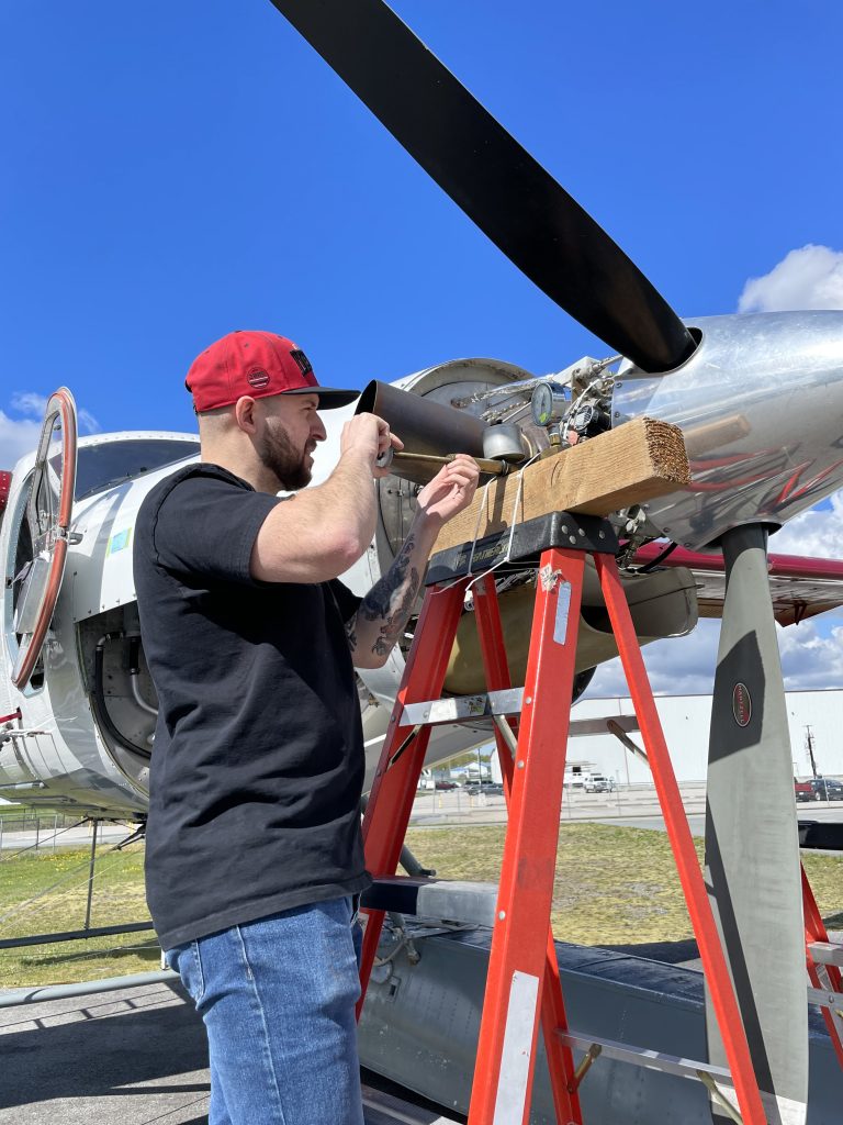
One interesting challenge we faced with this project was the fact the aircraft is on straight floats. This mean’s it is not at all equipped to land, or taxi on solid ground and must land on water, then be moved by beaching gear. Conveniently, the Pitt Meadows Airport (CYPK) is located next to the Fraser River where the Pitt Meadows Water Aerodrome (CAJ8) is located. With a large float plane ramp, the Turbo Otter was able to land on the Fraser River and water taxi to the ramp where we coordinated a beaching gear to pick it up. After our work was completed we arranged a beaching gear to move the Turbo Otter for our various system tests, and ultimately to bring it back to the river for its outbound flight.
View this post on Instagram
“The installation was flawless and certainly cleans up a busy looking cockpit. I’m still impressed how much information is cleanly displayed all on one screen. Most impressive was how such a major change only needed a quick flight test for routine checks then off for an 8 hours flight to Yellowknife which was seamless!”.
Josi
Director of Maintenance


