Keeping your database(s) current
In our February issue of MaxNews we addressed the value of Electronic Approach Plates. These, of course, need to be kept current, and unfortunately, this is both an ongoing task and expense. Compounding this issue is the fact that GPS navigators are not the only equipment that need updating. Glass displays, and even some radios have databases in them that need to be updated at some point. Let’s try to make sense of this ever-expanding task, how to go about it, how often, and most importantly how to save some money!
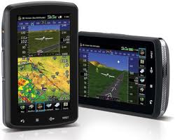
What? – It’s not uncommon for GPS navigators to have up to 6 databases in them . Nav data (airspace, freq, waypoints), approach plates, obstacles, terrain, and airport directories are just a few of the fields that may need updating.
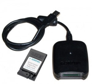
How? – This depends on the manufacturer and the model. For example, Rockwell Collins recently announced the release of their Ascend™ Aircraft Information Manager (AIM) which automatically uploads all required databases through WiFi or Cellular networks when you pull up to hangar. While this works great on corporate jets, the rest of us currently have to be content with a more modest solution. Most data updates require a datacard to be plugged into a computer, often with an adapter. You then need to contact either the manufacturer and/or Jeppesen to purchase a database with which, to program your card.
When? – Here’s where we can save you some money. First, flying VFR or IFR operations will dictate whether you need to keep current Nav data (typically updated every month).While IFR pilots are legally required to stay current, many VFR pilots update their Nav data only once a year or if any major airspace changes have taken place. Jeppesen will happily sell you an annual subscription for every database, but technically you only need Nav data on your primary navigation box. You can update things like terrain, obstacles, and airport directory at your discretion.

Cost? – Logically, those with the most systems to update pay the most. Realizing this, and with feedback from the pilot community, both Garmin and Jeppesen have started offering ‘Pilot Paks’. These are essentially discounted data bundles for aircraft with multiple systems. Apart from these savings and the ones mentioned above, you can also reduce database costs by specifying your region of flight. If you never leave the North West, there’s no reason to pay for all of the Americas. Likewise, a single cross-country flight, does not necessitate a permanent subscription — you only need to expand your database temporarily, to cover the one trip.
Where? – The easiest place to update your databases is at the hangar. That said, not all hangars have Internet access. While it is certainly possible to remove the card, bring it home, and update it at your leisure, this leaves the aircraft grounded until the card is returned. For this reason, it is not uncommon for pilots to have a second datacard on-hand. Alternately, you are more than welcome to use our computer and adapters here at Maxcraft, free of charge. If all this sounds daunting or like too much trouble, feel free to drop the cards off with us and for a small processing fee we will update them for you. While we can not sell you the databases themselves, if you drop by our office we would be more than happy to give you some guidance on the best configuration for your type of flying.
Maxcraft Avionics is a leader in airplane and helicopter avionic system upgrades like the Garmin GTN series, including installation of everything from a basic VHF Radio and simple Garmin portable GPS all the way to TCAS, EFIS, and autopilot systems. We have the largest avionics facility in Canada and we have over 20,000 unique part numbers in our in inventory to repair your aircraft or upgrade your cockpit
.
